
Three Decades of South American Urbanization History from Landsat
Published:
As one of the most urbanized regions in the world, South America witnessed dramatic urbanization over the past several decades. Currently, about 80% of South American population live in urban areas, which is twice the urbanization rate in the 1950s. This is largely driven by population growth, structural change in the economy, as well as government policies. And the unprecedented rate of urbanization has created great challenges for the environment, urban infrastructures, and governance.
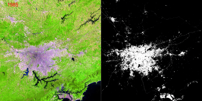
To fully understand the driving forces and impacts of rapid urbanization in South America, we need to examine its trajectory at fine spatial and temporal resolution. Landsat provides the longest record of land change. In this study, by mining spectral, temporal, and spatial information from Landsat imagery and using state-of-the-art machine learning techniques, we turn more than three decades (1985-2017) of Landsat data archive into annual records of urban change at 30m resolution. With the success of this approach, historical records and long-term monitoring of urbanization will be available for advancing urban science.
Stay tuned for more updates about this research.